Overview
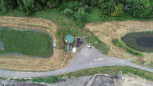
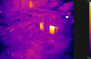
Unmanned Aerial Vehicles (UAVs) or drones are finding their way into many industries today. From engineering to preventive maintenance, the use of a drone with a high definition camera and FLIR thermal imaging can be used to obtain quality, detailed images. Capturing crucial amounts of data at a time, UAVs can be used in dangerous and hard-to-reach places. UAVs can be used to safely inspect oil and gas pipelines, power lines, substations, radio towers, windmills, solar panels, and other mission-critical infrastructures.

Benefits
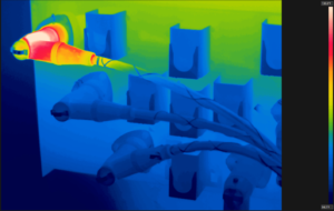
- Thermal imaging technology continues to come to the rescue in many critical situations
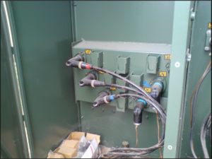
- Maintenance technicians can locate potential hazards by pinpointing overheating joints and other signs of failure
- By performing preventative maintenance scans, issues will be located earlier, allowing for planned repairs during an outage, instead of costly downtime
Capabilities
- Part 107 Remote Pilots Certified by the FAA
- Registered UAVs with the FAA
- Thermography by FLIR